The Lost Art of Locating Property Corners
Locating Property Corners
Article by Glen Tanner, Professional Land Surveyor, Copyright 2011, Used by Permission
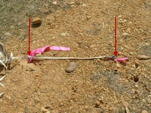 The art of finding property corners is being lost. The following picture shows what inspired this article.
In old neighborhoods, especially those that go up and down steep inclines, very seldom do the irons on the ground match the recorded plat or deed, in angle or in distance, and if you try to use a pre-set data collector and a total station, 9 out of 10 times you will not find all the property corners – not because they’re missing, but because you’re probably in the wrong place or weren’t looking hard enough.
We should always remember that in old subdivisions and old boundary surveys, surveyors used plumb bobs, chain, theodolite, and no one knows what the closure of the survey may have been, if it even had one.
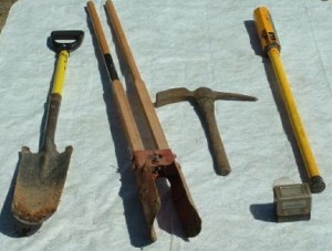 Almost all survey crews today have a magnetic pin finder and either a bushaxe or machete. But for some jobs, these aren’t adequate. As a Professional Surveyor, I use the tools shown to the left.
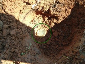
The following pictures were taken 3-16-11 but the work was done about a week before. (That is why you will see a post in the picture.) I re-dug the hole to get the photo of this rare find. The first item I found was the bottom of a coke bottle (center of the photo).
How many of your crew members would quit here, thinking this is garbage? Would they keep digging and discover the property corner UNDER the bottle?
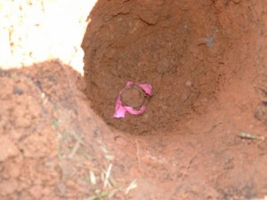
One open-top iron pipe found – the original property corner on this subdivision lot.
The deepest I have ever had to dig to locate an iron is 3 feet. I have found old irons that a tree has grown over or around as much as a foot in the tree. This lot was a 100 by 200 according to the plat, but on the ground along the road it measured 98 feet, along the rear of the lot, 96 feet and 198 feet in depth.
Boy, this one sure matched the plat. This lot originally was an Autauga county gully that has been filled. The plat was recorded in 1969 and all lots shown on the plat along the south line were shown to be 160 feet plus or minus. Do you believe the rest of the subdivision is going to match the plat?
Finding instead of setting property corners
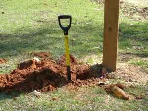 Ask anyone that knows me, they will tell you, before Glen Tanner quits looking and sets an iron, the ground will look like it has been attacked by armadillos and groundhogs.
Isn’t our duty as a land surveyor to follow in the footsteps of the original land surveyor as closely as possible, not to re-interpret or move a corner to where it calculates? Many of you surveyors are going to say that your “clients aren’t going to pay for it” or “I didn’t allow that much time in the job to be going back.”
That’s our job, Isn’t it? Isn’t it required by the Standards of Practice? Isn’t it our ethical duty to protect the public and to do these things regardless of what the client is willing to pay or how much time we have allowed in the job?The art to finding old irons is to listen to property owners, who know the area, or how it was surveyed, but most of all taking the time to look and dig.
That’s right – dig – a lot. My magnetic locator doesn’t have a brain, it didn’t go to school, it doesn’t speak English, Spanish or French – But, it will lie to you. Learn to understand your equipment, something that may take months, even a year or two.
Understanding the squeaks and squalls of the magnetic locator signal being sent to the user is important. Remember be patient, learn what what to look for and most of all – dig, dig, dig. THIS is the art of locating old property corners.
If you need help locating your property lines or property corners in the Dadeville area, please call the Dadeville land surveyors at (256) 307-1447. Our field crew strives to live up to the high standards Glen talks about in this article.
